In terms of territory, the biggest of all is the Tumucumaque Mountains National Park, which has more than one million km² and occupies more than 26% of the total area of the Amapá state.
By number of visitors, the biggest is the Tijuca National Park in Rio de Janeiro, which is the largest stretch of urban forest on the planet and receives around two million people every year.
Parque Nacional do Iguaçu
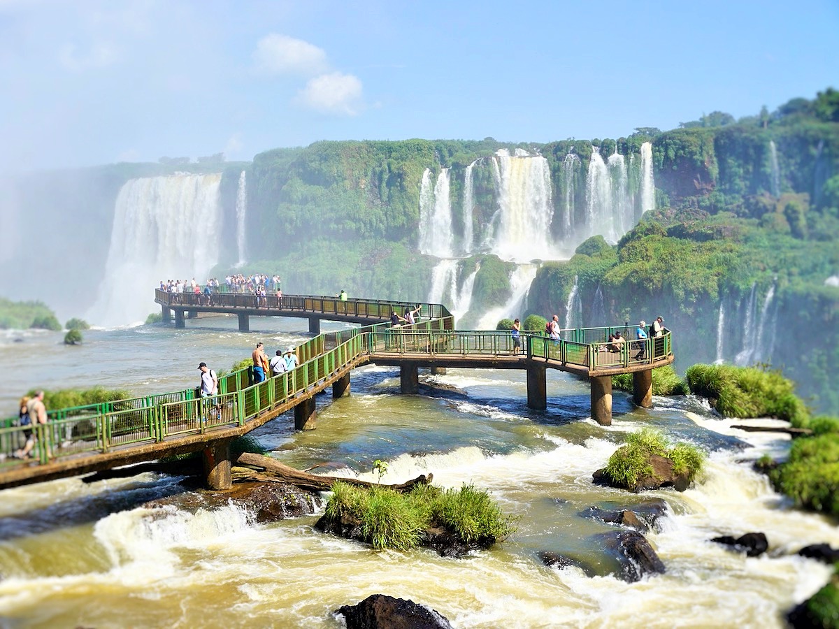
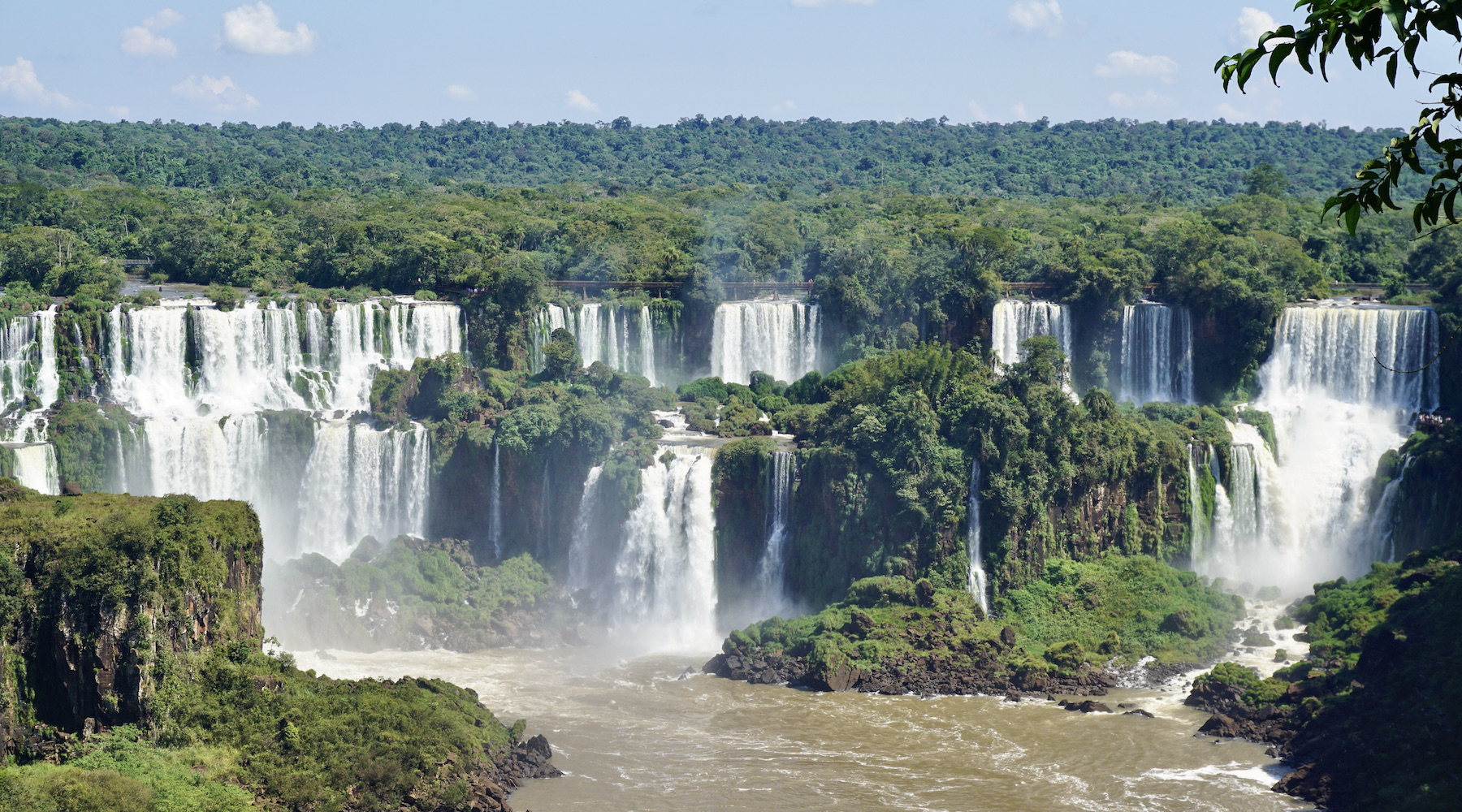
One of nature's most impressive spectacles, the Iguaçu Falls, are the main attraction of Foz do Iguaçu, a city located on the triple border with Paraguay and Argentina, the second most visited destination in Brazil.
Just step into the Parque das Cataratas to hear a dozen different languages. Foreigners, along with a growing number of Brazilian tourists, go there with the main objective of seeing the 275 waterfalls that make up one of the Seven New Wonders of Nature, forming a spectacular and unique scene in the world. With each step along the trails new falls emerge and its incredible average flow of 1.5 million liters per second.
What to do in Foz do Iguaçu
The main activity in the city, of course, is getting to know the Iguaçu National Park. The Brazilian park is well organized, the trails are easy to walk and allow you to admire beautiful landscapes. On trails that sometimes go right through the middle of the falls, you will be able to see the falls up close! And, if you want, inside the Brazilian park, you can also take the Macuco Safari; an attraction that allows you to enter the waters of the Iguaçu river by boat and even take a bath under the falls!
Visiting Foz do Iguaçu also offers the possibility of discovering small parts of two other countries that border Brazil: Paraguay and Argentina. Ciudad del Este, in Paraguay, is considered a shopper's paradise, and Puerto Iguazú, on the Argentinean side, is the perfect place to have a good dinner, enjoying delicious Argentinean meat. Another great attraction on the Argentinean side is, of course, the Iguazú National Park, which holds about 80% of the waterfalls that form in the waters of the Iguaçu river, as well as the possibility of taking walks with breathtaking viewpoints.
Itaipu Binacional, administered by Brazil and Paraguay, is also worth a stop on your itinerary; the largest producer of energy in terms of water volume in the world. It is also worth visiting the Marco das Três Fronteiras, which marks the triple border between the three countries in the region, the Parque das Aves, which has rescued birds of different species and the Buddhist temple in the city. There is no shortage of things to do in Foz do Iguaçu.
Climate info
Hottest month |
January (28 °C avg) |
|
Coldest month |
July (18 °C avg) |
|
Wettest month |
May (128.5 mm avg) |
|
Windiest month |
September (10 km/h avg) |
|
Annual precip. |
1019.5 mm (per year) |
December, January and February (summer months) are especially rainy and you may have cloudy skies, hot weather and high humidity. However, during these months the falls are at their peak (higher water levels). Visiting the Iguaçu Falls during March-April and August-September may be better; temperature are more comfortable and the risk of rain is smaller. On the other hand, the falls are not at their peak.
Parque Nacional da Chapada Diamantina
Chapada Diamantina, in the state of Bahia, is the perfect destination for those who enjoy ecotourism or adventure tourism. The region is rich in natural beauty and has enough attractions to keep travellers on a busy schedule for weeks.
After all, who doesn't like lush waterfalls, crystal-clear rivers, huge rock formations and ecological trails in the midst of a scenery of paradisiacal beauty?
In addition to the landscape, travellers can also discover well-preserved historic villages, a rich culture, welcoming people and excellent cuisine.
What to do in Chapada Diamantina
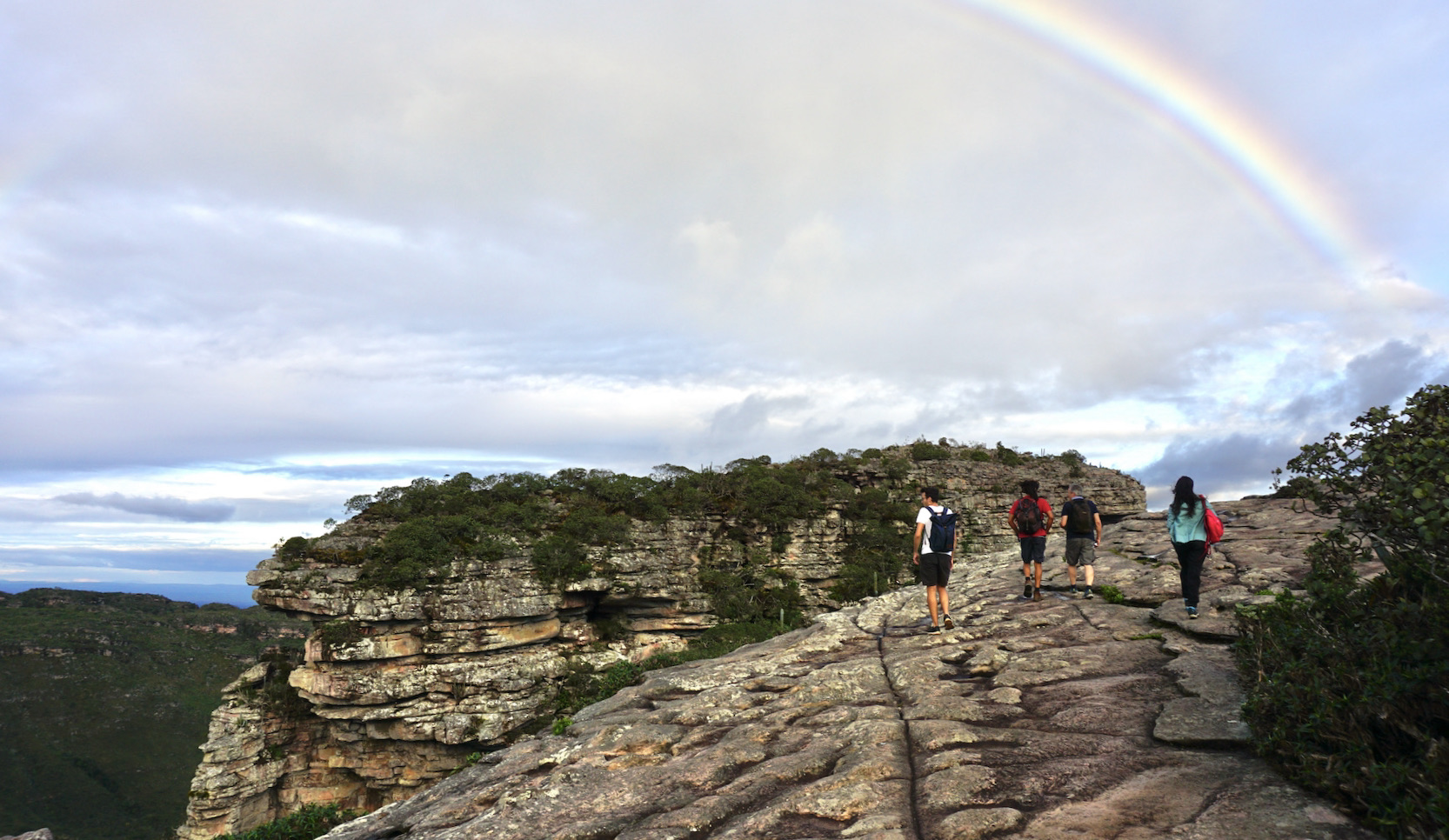
The main tourist attractions in Chapada Diamantina are all linked to ecotourism. And the goal of most visitors to the region is to enjoy as much as possible of the natural scenery, such as the magnificent Morro do Pai Inácio. Just waterfalls, there are more than 360 of them cataloged. Practically one waterfall per day of the year! Of course, going to all of them will be an impossible task, so start with the most famous. Cachoeira da Fumaça, Cachoeira do Buracão and Cachoeira do Mosquito are good options to start your tour, but it is good to have time to go to Cachoeira do Sossego, Cachoeira da Fumacinha and so many other beautiful waterfalls as well. And, to reach each one of them, there will always be a beautiful trail to be covered. Some take a few minutes, others take several days, such as the incredible Vale do Pati, considered one of the most beautiful trekkings in Brazil.
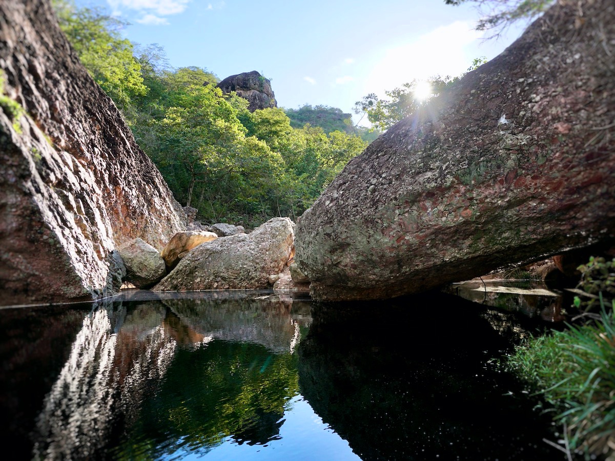
In addition to the waterfalls, other attractions that attract the attention of tourists are the wells inside the caves, where the effect of beams of light provide an incredible spectacle! It is worth going to Poço Azul, Poço Encantado and Gruta da Pratinha. All are experiences worthy of many photos. For the more adventurous, it's worth going up and down the caves and rocky walls doing rappelling, climbing or bouldering, or just exploring them on beautiful walks. It all depends on your wishes and skill level.
Climate info
Hottest month |
February (24 °C avg) |
|
Coldest month |
July (20 °C avg) |
|
Wettest month |
December (75.4 mm avg) |
|
Windiest month |
October (13 km/h avg) |
|
Annual precip. |
479.3 mm (per year) |
The Chapada Diamantina National Park is usually worth a visit year-round. During the rainy season, travellers can be a little restricted due to rainfall, but often these are rather short, strong showers, and therefore are usually a refreshing moment to cool off. The best time to travel to Chapada Diamantina is generally between May and September, when it is drier but still quite warm during the day.
Parque Nacional Marinho de Fernando de Noronha
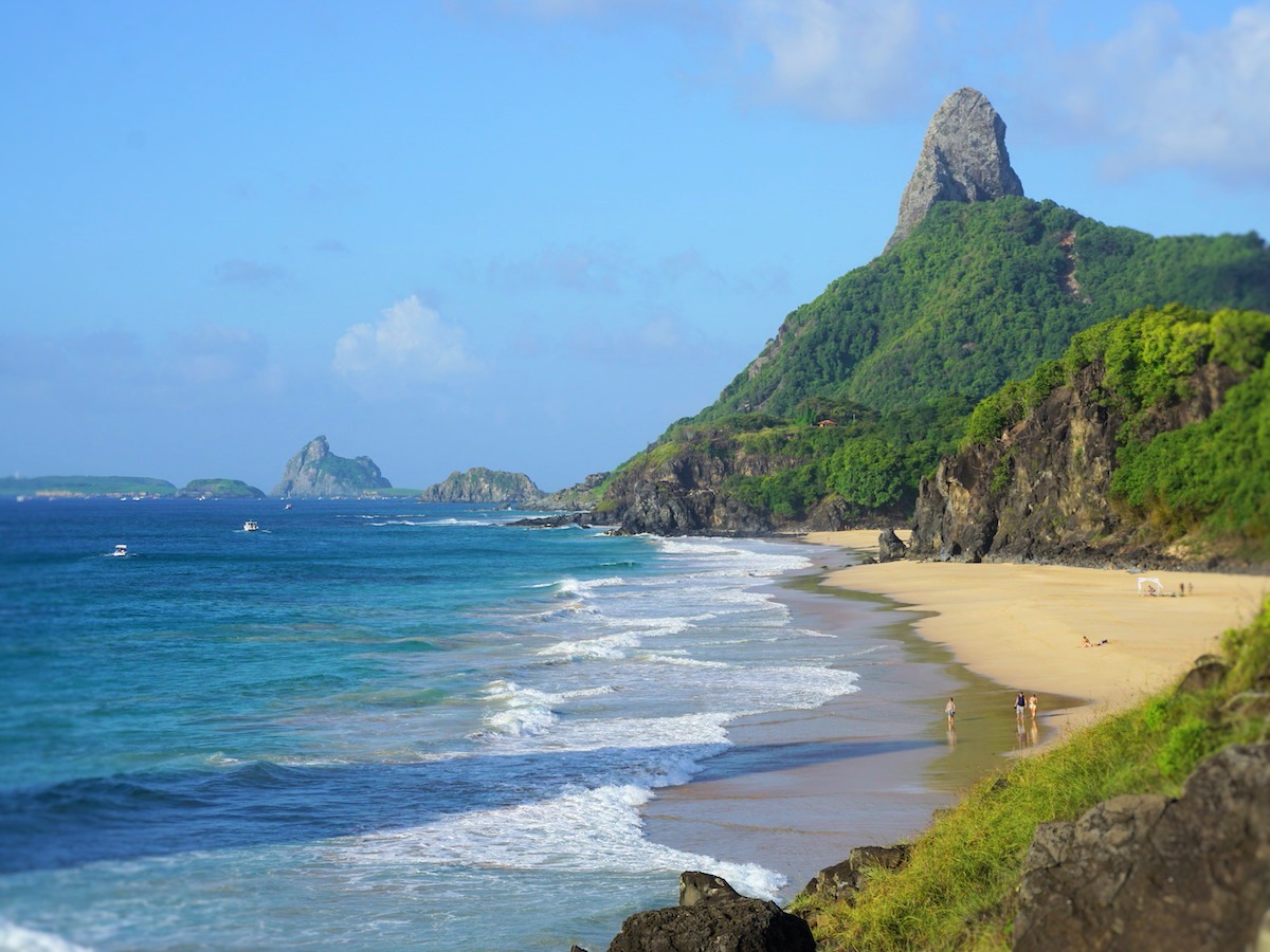
Get ready for a dream trip: Fernando de Noronha has the most beautiful set of beaches in Brazil. That's not nothing, especially when it comes to a country with more than 7,000 kilometer of coastline. Here, everything is excuisite. Like the unforgettable beauty of Baía do Sancho, Baia dos Porcos and Praia do Leão.
Also unforgettable is diving with sea turtles, sailing side by side with dolphins, watching the sunset from the beaches of Cachorro, Meio or the Boldró lookout. Get ready, as well, for an uneconomical trip. Most of the hotels on the island have high prices, as well as the most basic dishes in the restaurants, and the environmental and Marine National Park fees also increase the bills.
What to do in Fernando de Noronha
The main activities in Noronha revolve around the sea. When the sun is out, all tourists want to go to the beach to enjoy a refreshing swim. Anyone who wants to be surprised by crystal clear water and a heavenly view cannot miss the Baía do Sancho or the Baía dos Porcos. For those who want to stay close to the center, going to Praia da Conceição is also a good idea – this beach is a nice meeting point on the island, especially in the late afternoon.
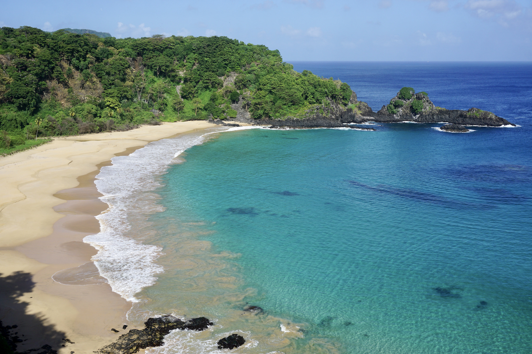
Taking advantage of the pure crystal clear waters, reserve a day to go scuba diving or snorkeling, and you will be dazzled by the marine diversity of Noronha. Small fish, turtles and small sharks are some of the species that can be observed at Praia do Sueste or Praia do Porto.
If you like adventure, it is worth booking one of the trails that the Marine National Park offers. Some trails must be scheduled in advance and require the presence of a guide. The short Atalaia trail does not need a guide and is very easy to do; on the other hand, the long Atalaia trail, which lasts about four hours, is more demanding, but equally beautiful!
Climate info
Hottest month |
February (27 °C avg) |
|
Coldest month |
August (25 °C avg) |
|
Wettest month |
April (358.5 mm avg) |
|
Windiest month |
September (25 km/h avg) |
|
Annual precip. |
1301.9 mm (per year) |
Fernando de Noronha is a year-round destination, but the best time to visit the islands and to fully enjoy its attractions is the dry season: from August to January. Fernando de Noronha’s climate is tropical with two well-defined seasons: the dry season, mentioned above, and the rainy season, from February to July. Air temperatures are fairly constant throughout the year (around 26ºC/78.8ºF), and water temperatures are great for all kinds of water sports: around 28ºC/82.4ºF, with almost no variation throughout the year.
Parque Nacional de Jericoacoara
Jericoacoara, located in the state of Ceará, is an incredibly beautiful fishing village that is well preserved and has a rustic air, as you will see once you have conquered the 23 kilometers of dunes between Jijoca and Jeri by 4x4.
Thanks to two factors the region remains relatively untouched: the first is the precarious access – Jeri is only reached by four-wheel-drive vehicles, after a lot of shaking. In 2017, however, the region gained an airport. But the still high ticket prices contribute to maintaining the village's roots style. In the same year, the charge of a tourism tax was introduced. The second is the transformation of the region into an environmental protection area, which happened in 1984, and later into a National Park, in 2002, preserving an area of about 200 square kilometers full of golden dunes, mangroves and transparent lakes.
What to do in Jericoacoara
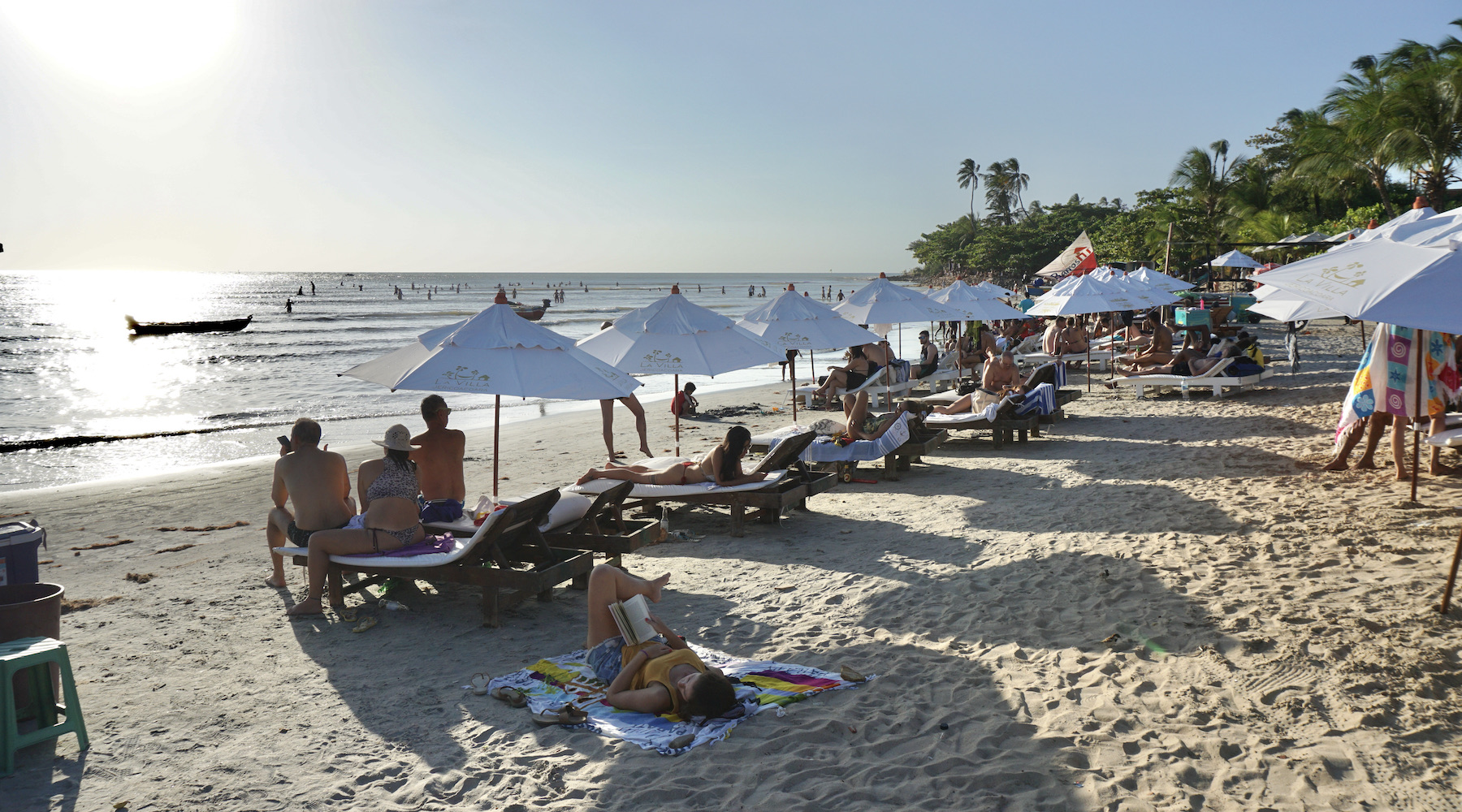
Most people who want to enjoy the sea, go to Jeri beach, the closest to the village. The beach has a nice vibe and getting some sun after a dip in the sea is rejuvenating. Some restaurants have sunbeds and umbrellas that make life easier for those who don't want to worry about too much. For those who want to practice or learn kitesurfing, this is the place to be. If you want to enjoy crystal clear water, you might prefer the lagoons rather than the sea.
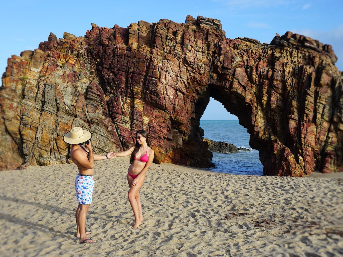
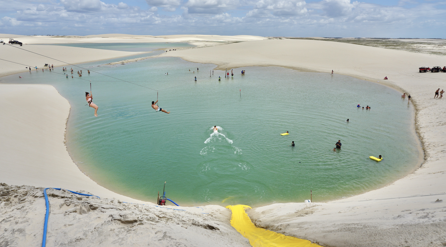
Jeri's natural attractions are, in large part, far from the village. On the west coast, the attractions you will find are the Mangue Seco, a trip through the dune area and the Lagoa da Tatajuba, which offers restaurants. On the east side, the most popular spot in the region, the biggest attractions are Lagoa Azul, the beautiful Lagoa do Paraíso, the Alchymist beach club and Pedra Furada. Jericoacoara's agencies offer tours to the east and west side, which can be done by buggy or 4x4 vehicles, privately or shared – it all depends on how you would like to carry out the activity.
The sunset is always an attraction in Jeri, and if you can, admire it every day of your trip, each day from a different place. You can follow the sun setting at Praia de Jeri, on the beautiful Duna do Pôr do Sol, which has a wonderful view, or if you prefer something more agitated, at the party that takes place on the rooftop of the Hotel Hurricane Jeri.
Climate info
Hottest month |
October (28 °C avg) |
|
Coldest month |
April (26 °C avg) |
|
Wettest month |
April (138.8 mm avg) |
|
Windiest month |
September (27 km/h avg) |
|
Annual precip. |
582.3 mm (per year) |
Jericoacoara is a tropical destination with a year-round air temperature of about 28ºC/82.4ºF and seawater temperature of about 24ºC/75.2ºF. The dry season (from June to January) has low levels of precipitation and humidity. That’s the best time – from a weather standpoint – to visit the region.
Parque Nacional dos Lençóis Maranhenses
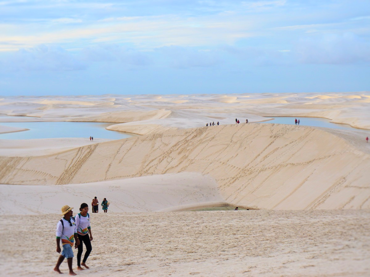
As much as photos, travel brochures, home videos or professional documentaries are a preparation for what you will find in Lençóis Maranhenses, there is nothing compared to being part of this immensity of dunes and lakes yourself. Those who observe this scenario from above, in a single-engine flight, immediately have a panoramic view of the mosaic of sand and emerald water in the Lençóis Maranhenses National Park.
Physical fitness and willingness to take long walks in strong sunlight are competitive advantages for those who defy the dunes. Intens hikes, cooling off in the lakes, staying overnight in fishing villages – an adventure that should only be undertaken with the help of guides. To enter the park, the most popular option is Barreirinhas, where resorts, inns and agencies that organize tours have been open for about a decade.
What to do in Lençóis Maranhenses
The Lençóis Maranhenses National Park covers an area of 155,000 hectares and is considered the largest dune park in Brazil. The protected area is huge, but the Lençóis Maranhenses region is even bigger than the National Park. Among the most popular tours are the Circuito Lagoa Azul, Circuito Lagoa Bonita, Circuito Lagoa das Emendadas and the Canto de Atins. Certainly unmissable tours for those going to Lençóis Maranhenses.
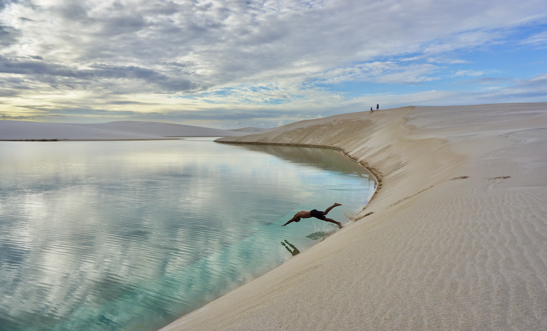
Although the lakes are the main attractions, tourism here goes much further. Visitors to Lençóis Maranhenses can invest in days at Caburé beach and Atins, in tours along the Preguiças and Formiga rivers, and even in the practice of kite surfing, which is growing a lot in the region. Everything involving tours by 4x4 vehicles, beautiful landscapes, transparent waters and always fine and very white sand. And as if that wasn't enough, it's still possible to appreciate the immensity of Lençóis Maranhenses in a flyover for an unforgettable experience!
Those who wish to go even deeper into the experience can invest in crossing the Lençóis Maranhenses National Park on foot. This route, which takes three to five days, is the dream of many adventurers and is certainly the best and most intense way to experience the place.
Climate info
Hottest month |
November (28 °C avg) |
|
Coldest month |
May (26 °C avg) |
|
Wettest month |
april (223.5 mm avg) |
|
Windiest month |
September (27 km/h avg) |
|
Annual precip. |
884.2 mm (per year) |
The breathtaking dune landscape in the Lencois Maranhenses National Park is generally worth a visit year-round. However, the best time for a tour tends to fall between June and September, as during this time there is usually enough water from the past rainy season in the lagoons to be able to admire them and go for a swim. At the same time there is no more heavy rainfall, so you can enjoy the fresh air without constantly getting wet.
Parque Nacional da Chapada dos Guimarães
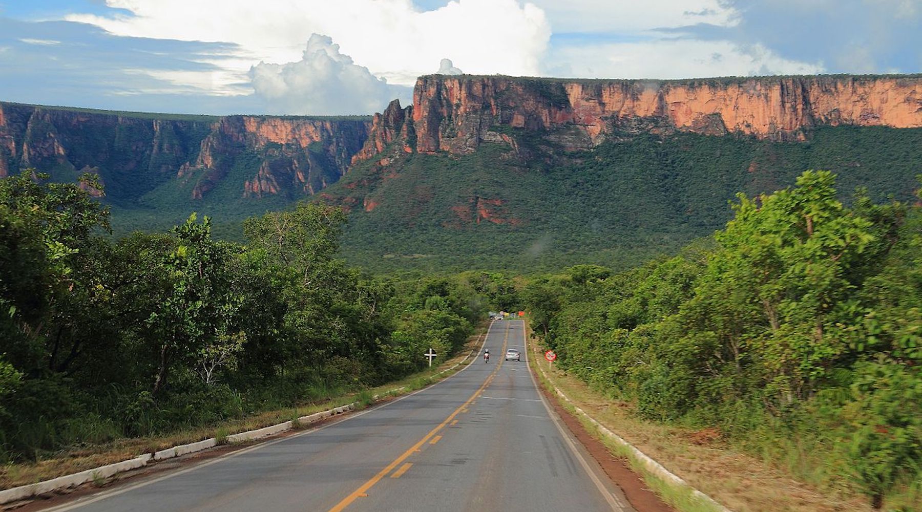
Stunning red-orange sandstone walls – Trademarks of the Chapada dos Guimarães – welcome the tourists who visit the city, just 69 kilometer from the capital Cuiabá. Gateway to the National Park, the town that carries the same name as the reserve, offers comfortable inns and cozy restaurants.
11 kilometers from the center of the village, the park occupies an area of 33,000 hectares. This perfect setting combines savanna, waterfalls and canyons, as well as rock paintings and formations that satisfy the eyes of ecotourists.
The many trails, ventured on foot or bike, lead to natural viewpoints that uncover mountainous masses and, on clear days, reveal the Pantaneira plain and the capital city Cuiabá.
What to do in Chapada dos Guimarães
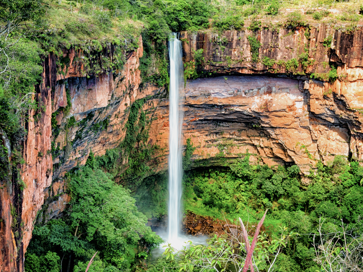
Get ready for unforgettable days in the middle of nature! There is a lot to see and do in Chapada dos Guimarães. The Cachoeira dos Namorados and Cachoeirinha waterfalls have an easy access, which is on the same route as the Véu de Noiva viewpoint – the most famous attraction of the park. The trail is self-guided and has a length of 1,300 meters.
The Waterfall Circuit (Circuito das Cachoeiras) is the perfect tour for those who love waterfalls. It is a trail of about six kilometers (round trip) that can be done in about six hours of walking with a stop at six waterfalls (7 de September, Pulo, Degraus, Prainha, Andorinhas and Independência) and two natural pools.
One of the most incredible views of Chapada dos Guimarães is found at the top of the São Jerônimo hill, which is one of the highest points in the National Park. For this tour it is necessary to have physical resistance: a hard walk of five to six hours, including climbs, descents and a small stretch of climbing.
Climate info
Hottest month |
September (27 °C avg) |
|
Coldest month |
June (22 °C avg) |
|
Wettest month |
February (190.0 mm avg) |
|
Windiest month |
October (10 km/h avg) |
|
Annual precip. |
841.6 mm (per year) |
Chapada dos Guimarães is usually attractive as a year-round destination. However, the best time to enjoy the region is during the dry season, which runs from April to September. During the rainy season, from October to March, heavy rainfall can occur constantly. This means that some roads may not be very passable.
Parque Nacional da Chapada dos Veadeiros
Located on top of a gigantic quartz stone in the interior of Goiás, Chapada dos Veadeiros is one of the most interesting sights in the country. In addition to the fantastic waterfalls, the beauty of the Brazilian savanna and being the best place in Brazil to observe the sky, the Chapada dos Veadeiros is, above all, mystical. Just pay attention upon arrival at the entrance of Alto Paraíso, the base-city for visitors: there is a gigantic portal that resembles a spaceship and often there are sellers specialized in the trade of extraterrestrial sculptures.
There is even a small airport for UFOs and, according to the locals, there is a traffic of unidentified flying objects above the place. To further increase the mystical atmosphere, the region is in the same latitude as Machu Picchu, which would be responsible for a special energy.
Believing or not in the mysticism, Chapada dos Veadeiros is a very interesting destination for tourism. The trails to the most famous waterfalls are well signposted, adventure tourism is poupular in the region and there is a good infrastructure to receive visitors.
What to do in Chapada dos Veadeiros
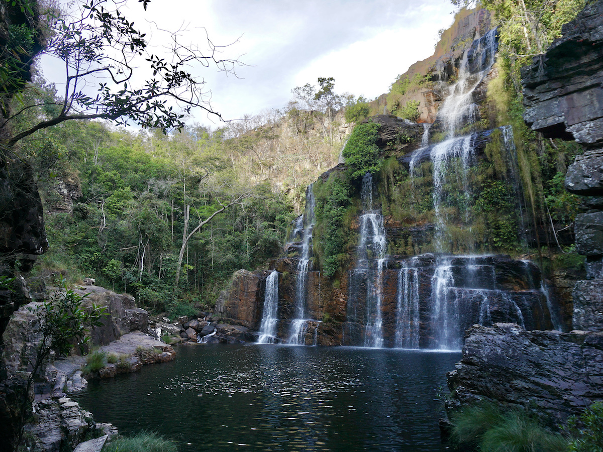
The waterfalls are the great attraction of the Chapada dos Veadeiros National Park and it's worth taking a bath in each one of them. The Santa Bárbara waterfall has become one of the most famous in the area, but there are many different options that are worth entering the script, among them the Saltos do Rio Preto and Cachoeira das Cariocas waterfalls. Outside the main circuit of the park, it is worth checking places like: Cachoeira do Segredo, Cachoeiras Almécegas I and II, the always incredible Vale da Lua, Catarata dos Couros, Cachoeiras do Prata and many others.
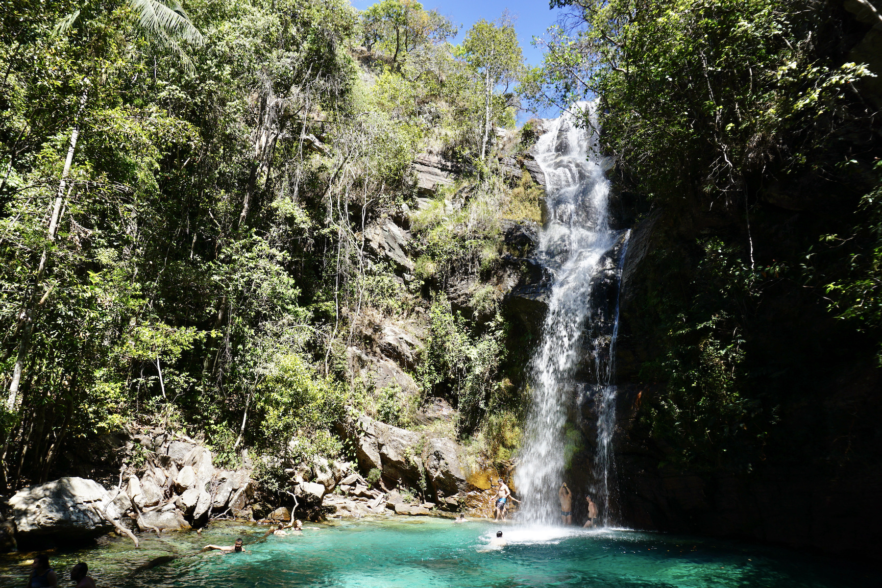
With several self-guided trails, the park pleases especially travellers who prefer independent tourism. It will almost always be possible to reach the waterfalls without hiring guides or tourism agencies, which makes the trip cheaper and more intimate. But if you're not made for the explorer life, do not worry! It will be easy to hire a guide to go on tours in the region. It is worth saying that most of the attractions have paid access, but the values are accessible and do not weigh heavy on your budget. To start off with a beautiful path, try the trail of the Mirante da Janela (window viewpoint).
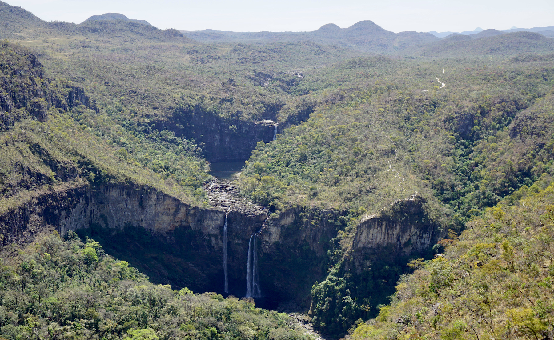
In addition to the invigorating cold waterfall baths, Chapada dos Veadeiros also offers other spectacular experiences, such as a late afternoon in the Jardim de Maytrea, bathing in the natural pools of thermal waters, and, for the most alternative, a wide variety of mystical and holistic treatments. Not to mention the delicious nights between the bars, restaurants and fairs of the villages of São Jorge and Alto Paraíso. The Chapada dos Veadeiros is a place to enjoy without haste and where there's always a good exchange of energy.
Climate info
Hottest month |
September (26 °C avg) |
|
Coldest month |
July (19 °C avg) |
|
Wettest month |
December (288.3 mm avg) |
|
Windiest month |
August (13 km/h avg) |
|
Annual precip. |
1485.1 mm (per year) |
In general, the Chapada dos Veadeiros national park is an interesting destination year-round. Usually the weather is very warm throughout the year with rainfall varying a lot depending on the season. Expect heavy rainfall and high humidity during the rainy season, which runs from October to April. Also be aware that during the rainy season some roads may not be easily accessible. The dry season lasts from May to September and offers very little precipitation.
Parque Nacional da Tijuca
Located in the heart of Rio de Janeiro, the Tijuca National Park was created in 1961 and brings together some of the most coveted attractions of the “Marvelous City”, as well as great options for tours for those who enjoy ecotourism and adventure sports.
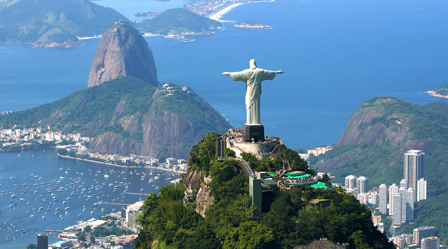
Protecting the Corcovado mountain and the Christ the Redeemer monument alone would make Tijuca National Park already a very special place in the city of Rio de Janeiro, but the park is much more than that: it also protects the world's first replanted forest, a multitude of trails and waterfalls, as well as historic ruins from the time of the coffee farms. All this right in the center of Rio de Janeiro. The Tijuca National Park is undoubtedly a key part of making Rio de Janeiro the well-known Marvelous City.
Tijuca National Park has a lot of history as well: its forests are the result of the first major reforestation project in the world. After the almost total destruction of the forest for charcoal production and coffee plantations, the water sources that supplied the city began to dry up, after that, a process of expropriation of the coffee farms in the region and the replanting of more than 100,000 trees began.
What to do in Tijuca
The city's main attraction is located on a 704 meter high stone mountain. Viewed from all over Rio de Janeiro, this Christ the Redeemer monument was elected in 2007 one of the Seven Wonders of the Modern World and one of the Seven New Wonders of the World. The statue was inaugurated in 1931, after about five years of work, and is 38 meters high and weighs approximately 1,100 tons. It is the second largest statue of Christ in the world.
The Circuito dos Picos is a hike of approximately 19 kilometers and passes through the ten main peaks of the national park, including the famous Pico da Tijuca and Bico do Papagaio. The trail begins at the gate of the Afonso Viseu square and passes by numerous natural and cultural historical attractions along its entire path, such as Pedra do Conde, Morro do Anhanguera, Mirante do Excelsior, Pico da Tijuca, Bico do Papagaio, Morro da Taquara, Museu do Açude and Mirante da Cascatinha.
At the foot of Christ the Redeemer, the Paineiras road is one of its access roads. Along the way, visitors will find some mineral water sources, as well as several viewpoints with exceptional views of the South Zone of the city, including the Rodrigo de Freitas lagoon, the beaches of Copacabana, Ipanema and Leblon, and the Cagarras Islands Natural Monument. On weekends, the five kilometer stretch is exclusively for pedestrians.
Climate info
Hottest month |
February (24 °C avg) |
|
Coldest month |
July (18 °C avg) |
|
Wettest month |
January (87.4 mm avg) |
|
Windiest month |
September (10 km/h avg) |
|
Annual precip. |
679.3 mm (per year) |
The city and region of Rio de Janeiro has a privileged climate, with many clear-sky days and without much rain. During the summer, the region's climate is at its peak and the heat is intense every day of the season, which can reach 40°C. This is the perfect time to enjoy the waterfalls that the park is home to. For hiking and exploring the trails in the region, the best time is autumn and winter, when the weather is milder and more humid.
Parque Nacional da Serra da Bocaina
Mountains and sea combine in Serra da Bocaina to offer visitors one of the most complete destinations for ecotourism in Brazil. Created as an environmental preservation area, Serra da Bocaina National Park has become a natural paradise for those interested in adventure tourism. Within 134 thousand hectares, the variety of attractions is enormous, being provided mainly by the altitude variation.
The Trilha do Ouro, which is the most popular trail, and many others lead to places where it is possible to observe nature as far as the eye can see, such as the Mirante do Sobrado viewpoint and Pico do Tira Chapéu, the highest point in the park.
Rivers and waterfalls also blend into the scenery, where the animal and plant diversity of native Atlantic Forest species remain untouched.
What to do in Serra da Bocaina
The main attraction of the park is the Trilha do Ouro, also known as Caminho de Mambucaba, this trail is an old colonial path built by the Indians in the 17th century to transport the gold that came from Minas Gerais. With 40 kilometers in length, the crossing is covered in three or four days of moderate walking, passing by historical places, such as centenary farms and ruins of an old sugar cane mill, and the most famous waterfalls in the region, such as the Santo Izidro, Veados and Posses waterfalls.
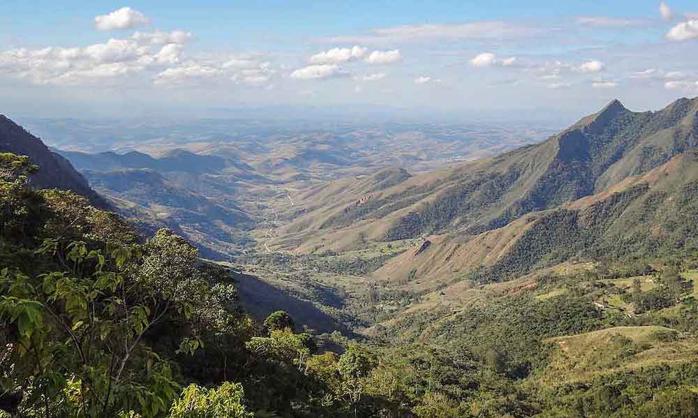
The Pico do Tira Chapéu is the highest point of Serra da Bocaina with more than 2,000 meters of altitude, from where it is possible to see from the Paraíba Valley to the bays of Angra dos Reis and Paraty. The nine kilometer trail to the top, although not very difficult, can last up to two hours depending on the pace of the hike. Pico da Bacia is the second highest summit in the region, with 2,050 meters of altitude, just behind Pico do Tira Chapéu. It offers a beautiful view of the cities of the Paraíba Valley, such as Resende, Itatiaia, Cruzeiro and the Serra da Mantiqueira. It is necessary to face a trail of 16 kilometers in total (round trip) to reach its top.
Cachoeira Santo Izidro, unlike the other waterfalls, can be accessed by a very quiet and short trail from the plateau of Serra da Bocaina. It is formed by a sequence of two falls and has a beautiful pool of crystalline waters and emerald green tones, ideal for a relaxing dive. It is one of the most amazing tours of Serra da Bocaina and also one of the favorite waterfalls to go for a swim.
Climate info
Hottest month |
January (24 °C avg) |
|
Coldest month |
July (19 °C avg) |
|
Wettest month |
January (255 mm avg) |
|
Windiest month |
October (7 km/h avg) |
|
Annual precip. |
1379.3 mm (per year) |
In general, the best time to visit Serra da Bocaina is between the months of May and August, when the rains stop and the trails get drier. However, this is also the coldest season in the region, with temperatures falling as low as 10°C. Although this discourages bathing in waterfalls, these are the ideal conditions for butterflies to proliferate through the mountains, forming a colorful spectacle.
Parque Nacional de Brasília
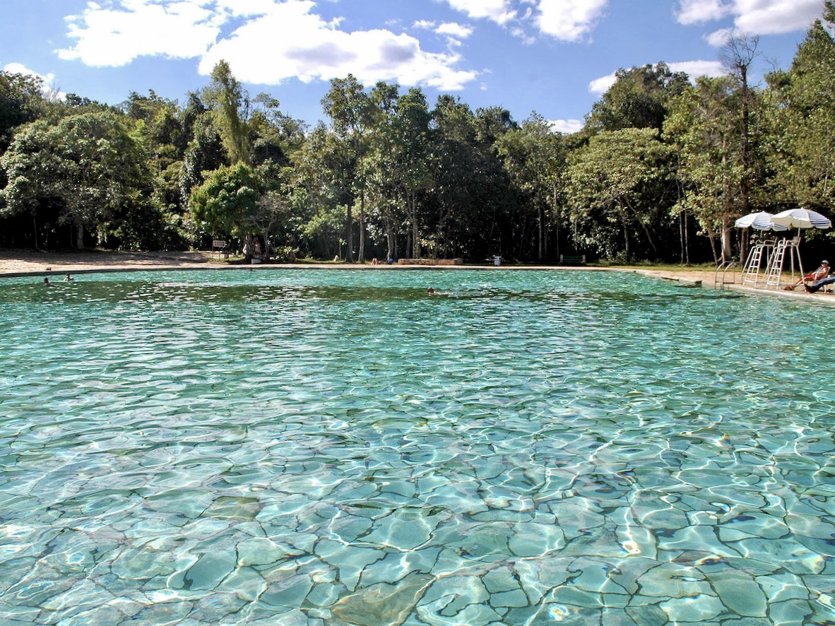
Better known as Água Mineral, Brasília National Park is an ecological park and has trails and natural pools, making it an excellent leisure option in Brasília. The park has two pools of mineral water that are always flowing, space for picnics and barbecues in the shade of the trees, as well as walks and trails in the woods.
Altogether, the park has 30 thousand hectares of extension. The area is preserved and thus contributes to the preservation of natural ecosystems in the region and maintains the vegetation in a natural state, contributing to the balance of climatic conditions and preventing soil erosion in the Federal District.
What to do in Brasília National Park
The Brasília National Park has two trails, the Capivara trail, which takes about 20 minutes to finish, and the Cristal Água trail, which lasts around one hour. But the main attraction is the swimming pools. They were formed from the water wells, which arose on the banks of the Córrego Acampamento, by the extraction of sand carried out before the creation of Brasília.
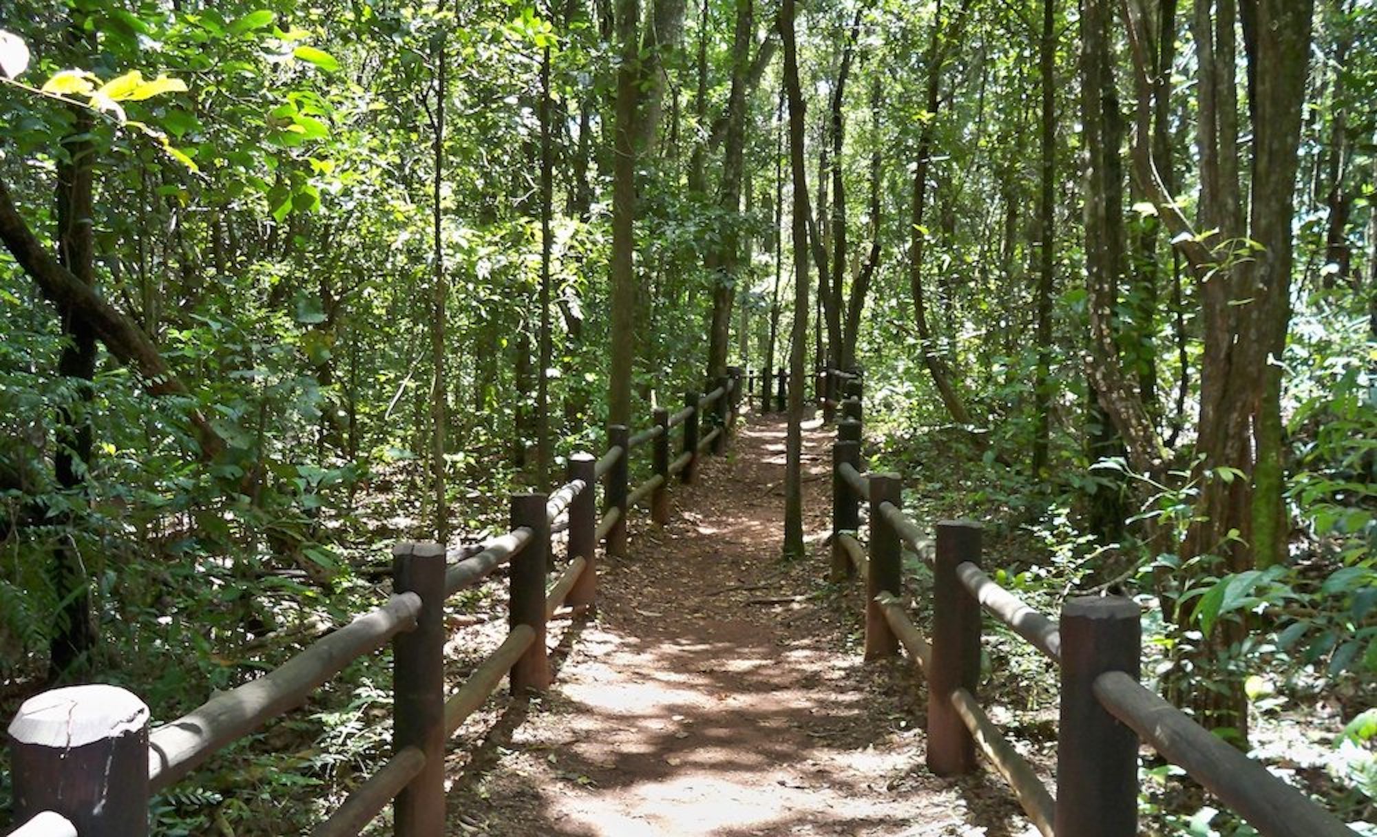
The park also has dozens of springs that sprout from the earth with pure and clean water. The park's waters form three important hydrographic basins in the Federal District; the Tocantins, Paranoá and the São Francisco basin. One of the springs that draws the most attention in the park is the Peito de Moça spring, one of the most beautiful in the park. The name was given due to a small elevation in the rock, which left it in the shape of a breast, where pure and crystalline water gushes.
Climate info
Hottest month |
October (25 °C avg) |
|
Coldest month |
June (20 °C avg) |
|
Wettest month |
December (334.2 mm avg) |
|
Windiest month |
September (12 km/h avg) |
|
Annual precip. |
1434.6 mm (per year) |
During the rainy season Brasília generally gets a lot of rain. If you want to visit the park between October and April, the rain might interfere with your plans. However, temperatures are high throughout these months. The dry season begins in May – a wonderful month to visit the park; air temperatures are pleasant and the gardens and trails are more beautiful.
Parque Nacional de Aparados da Serra
The Aparados da Serra National Park is one of the most spectacular regions in Southern Brazil. Full of beautiful landscapes and tours for those who like adventures, such as hiking, extreme sports and horseback riding, this place seems to have been drawn by hand.
Aparados da Serra is located between Santa Catarina and Rio Grande do Sul. The region has more than 30 thousand hectares and has a vast area of natural preservation.
The Park has a variety of attractions and perfect places to practice sports activities; you can go hiking, diving in waterfalls, horseback riding and abseiling.
What to do in Aparados da Serra
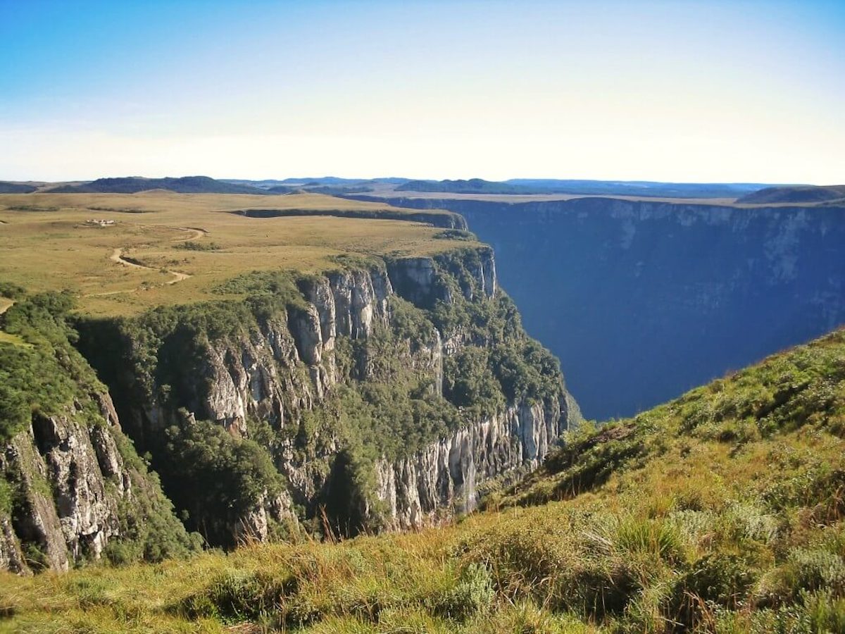
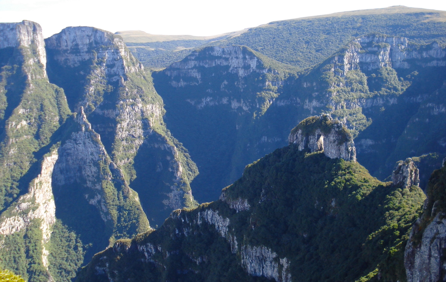
The most famous trail of the park, the Trilha do Rio do Boi, takes place inside the canyon cleft and is located 12 kilometers from the center of Praia Grande. It is a good option for those who like to push their limits, as it is not a trail for beginners, mainly because in some stretches it will be necessary to cross the river. Also, bring good walking shoes: the trail lasts from five to eight hours, but it's worth every moment spent there! The tour is really phenomenal, in addition to the canyons of almost 800 meters deep, you will pass by waterfalls, wells and breathtaking views. At the end, you can see the inverse view of the Itaimbezinho Canyon.
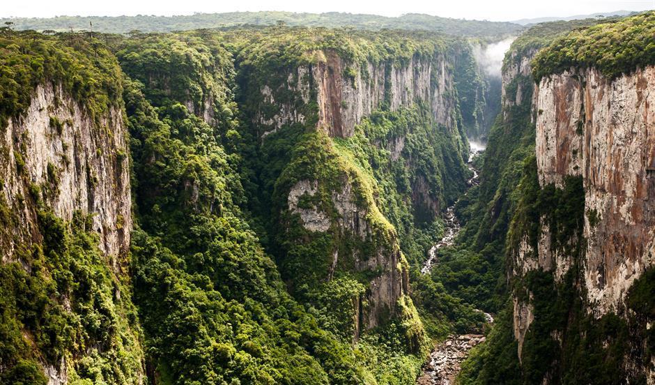
There are nine canyons located within the Aparados da Serra and Serra Geral parks, of which the biggest attraction is the Itaimbezinho Canyon, extending for about 5,800 meters, with a width of 2,000 meters and a height of 720 meters. There, it is possible to do two trails, the Cotovelo and the Vértice, where you will take a walk along the edges of the canyon, and to complete all routes on foot it will take you about three hours. See the grandeur of nature in its entirety, unique views of the canyons and also the waterfalls of Andorinhas and Véu de Noiva.
In addition to the fame of the Itaimbezinho Canyon, the Índios Coroados Canyon has a beautiful view of the sunset, where you can feel the energy of the environment and relax with all the peace it has to transmit.
Climate info
Hottest month |
February (20 °C avg) |
|
Coldest month |
July (12 °C avg) |
|
Wettest month |
October (222.5 mm avg) |
|
Windiest month |
September (12 km/h avg) |
|
Annual precip. |
1349.3 mm (per year) |
You can visit this park any time of the year. However, there are two important climatic characteristics: between November and February temperatures are higher and visits to waterfalls and trails crossing rivers are more pleasant. However, the season is more susceptible to rain. In winter, between June and August, the weather is drier and the probability of rain is much lower, but temperatures drop a lot.
Parque Nacional da Serra Geral
The Serra Geral National Park is an extension of the Aparados da Serra National Park. It was created in 1992, as a way to expand the area of protection of the territory formed by large Brazilian canyons, thus increasing almost three times the size of legal protection area of the local ecosystem. It reproduces the same rugged landschape, with the formation of walls and canyons, such as the Fortaleza canyon, which is up to 500 meters high.
Divided into two areas, one of 15 thousand hectares and another of 2,300 hectares, the vegetation of the park preserves a significant portion of altitude fields, forests with Araucaria and Atlantic Forest, and is cut by several rivers of shallow depth and waterfalls such as the Bonito, Porteira Velha, Pai José and Costão Novo waterfall.
What to do in Serra Geral
There is a short and easy trail to see the Fortaleza Canyon, one of the biggest canyons in Brazil. She is about 500 meters high in every direction and is flat. The Trilha do Mirante trail takes you to the edge of the canyon and is about three kilometers (round trip), and leads visitors to the viewpoint (also known as "sacada"), the highest point in the region.
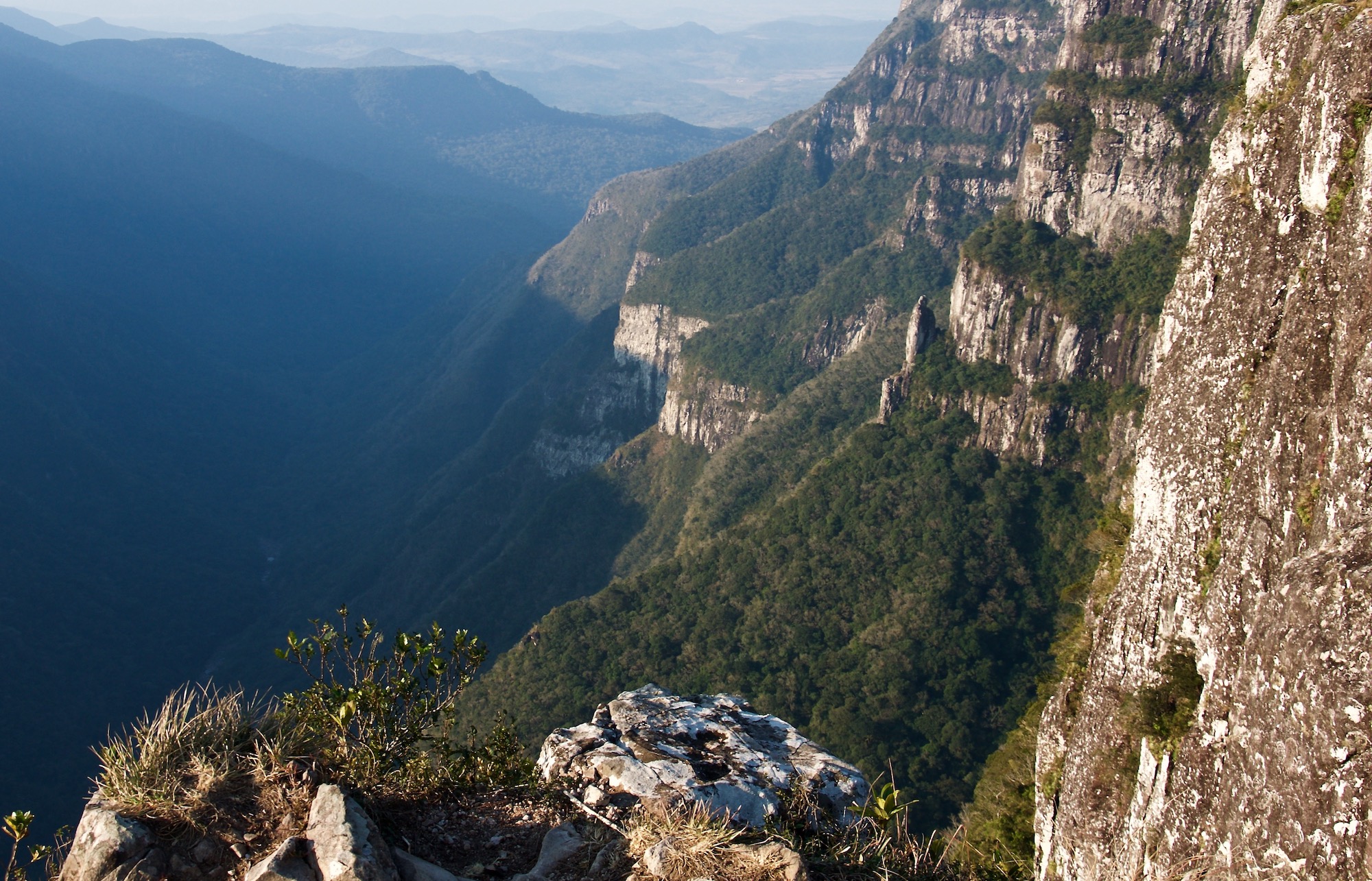
Within the park's limits there are more than four large canyons, of which the Fortaleza and Malacara Canyons are the best known. The Fortaleza Canyon is the most explored and has the easiest access being well at the park's gate, 23 kilometer from the urban area of Cambará do Sul. The trails to the edges of Canyon Fortaleza are liberated by the ICMBio to access freely, but the use of local guides is always recommended. To explore the edges of the other canyons in the park, as well as accessing the canyon's clefts, it is mandatory to contract a local guide.
Climate info
Hottest month |
February (20 °C avg) |
|
Coldest month |
July (12 °C avg) |
|
Wettest month |
October (196.4 mm avg) |
|
Windiest month |
October (11 km/h avg) |
|
Annual precip. |
1747.1 mm (per year) |
The weather is clearer in winter, but you have to face the cold, and it rains more between September and January. Therefore, the best time to visit the park might be between February and August. Visit the park in the morning to avoid overcast later in the day.
Parque Nacional da Serra dos Órgãos
The Serra dos Órgãos National Park is an area of conservation with a rich ecosystem, where it is possible to experience various types of tours and practice radical sports such as rapel, climbing and hiking. In addition, it counts on 200 square kilometers of extension, showcasing numerous mountain peaks and waterfalls.
The mountains called Dedo de Deus and Escalavrado are iconic. Along with nearby peaks, they form steep rock walls with dramatic characteristics and can be seen on any clear day from within the city of Rio de Janeiro.
Altogether, this national park is a paradise for people who enjoy adventure and practicing ecotourism amidst preserved nature. It is worth knowing that this park borders the most beautiful cities in the state of Rio de Janeiro, such as Guapimirim, Teresópolis and Petrópolis.
What to do in Serra dos Órgãos
The Dedo de Deus peak (finger of God) is a great rocky formation that, from its viewpoint, provides an incredible view of the natural beauty of Rio de Janeiro. In addition, its height of 1,692 meters allows the practice of radical sports, such as mountaineering. This peak stands out in relation to the others because of its form, which looks like a finger pointed up. So his name was born: finger of God.
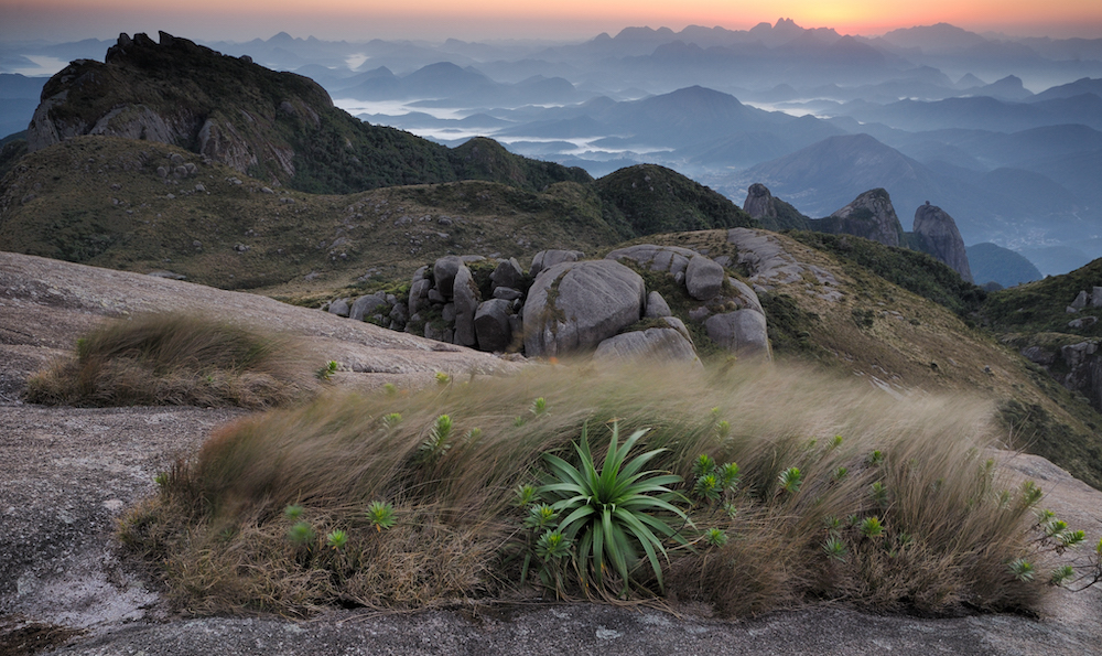
The Pedra do Sino peak has an altitude of 2,275 meters, making it possible to practice mountaineering and camping. In addition, the peak has a breathtaking view, being the perfect place for adventurers. Because of the high altitude, the temperature on this mountain falls considerably during the coldest period of the year, making it possible to observe even small layers of ice.
Among the three gateway cities of the park, Petrópolis is the less structured. And the visitor's profile is more adventurous, compared to those arriving by Teresópolis or Guapimirim. From there leave three trails: the Circuito das Bromélias, which leads to five wells with natural pools; a trail leading to the Véu da Noiva waterfall, where rapel and cascading can be practiced; and a trail to the Pedra do Açu peak, from where the Bay of Guanabara and the finger of God can be observed – the last trail is also the first stage of the classic crossing that connects Petrópolis to Teresópolis.
Climate info
Hottest month |
February (23 °C avg) |
|
Coldest month |
July (18 °C avg) |
|
Wettest month |
December (242.4 mm avg) |
|
Windiest month |
September (8 km/h avg) |
|
Annual precip. |
1342.3 mm (per year) |
The best months to visit this national park, are May to October, when there's less rain, and November to February, when the water in natural pools is not as cold.
Parque Nacional de São Joaquim
Deep valleys, mountains cut out by narrow roads and one of the colder climates in Brazil are some of the scenery of the São Joaquim National Park, in the Serrana region of Santa Catarina, 165 kilometers from Florianópolis.
It was in this park where Brazil recorded one of the lowest temperatures in 1996: -17.8 °C, on the hill called Morro da Igreja, where the Pedra Furada is located – a rock with a central slit of 30 meters in diameter.
São Joaquim National Park was created with the objective of protecting remnants of Araucaria Forests in the mountain regions of the south of the Santa Catarina state. One of the characteristics of the park is its geological formation of about 133 million years old, composed of volcanic rocks (basalt) that give rise to an ideal place to recharge energy.
What to do in São Joaquim
The Morro da Igreja and Pedra Furada are the most famous natural attractions in the park and are at the limit of the Catarinenses Municipalities of Bom Jardim da Serra, Orleans and Urubici. The viewpoint of the Morro da Igreja, at 1,822 meters of altitude, is one of the highest in Southern Brazil, and has a view at the natural stone monument Pedra Furada, a natural portal of about 30 meters in diameter.
With a steep slope and uneven ground, the Pedra Furada trail of 6.2 kilometers (round trip) gives access to the rock and overlooks the walls of the Serra Geral.
Known as "Campos de Santa Barbara", in the central sector of São Joaquim National Park, the region is marked by altitude fields and waterfalls, with peaks above 1,650 meters, and houses trails ranging from one to eight kilometers long, known as the Santa Barbara hiking tracks. One of the highlights is the trail of the Cemitério Histórico, with centenary constructions.
Climate info
Hottest month |
February (16 °C avg) |
|
Coldest month |
July (9 °C avg) |
|
Wettest month |
January (199.4 mm avg) |
|
Windiest month |
September (11 km/h avg) |
|
Annual precip. |
1625.3 mm (per year) |
The region's main attraction is the cold weather and the possibility to see snow, so the best time to visit São Joaquim might be winter, between May and August. If you prefer a warmer climate to explore the region, best to visit between September and April when temperatures are higher.
Parque Nacional Cavernas do Peruaçu
With an incredible geological and archaeological heritage, the Cavernas do Peruaçu National Park is one of the must-see destinations to practice ecotourism in Minas Gerais.
The park, besides having surreal caves, keeps an invaluable treasure: rock paintings that can be up to 9,000 years old. The level of conservation of these records is amazing, as well as the grandeur of the caves that harbor them.
The trails that run through the National Park pass by breathtaking landscapes and provide fantastic experiences as they reveal the interior of caves and prehistoric records.
What to do in Cavernas do Peruaçu
The main attraction of the park is the Gruta do Janelão, which is immense. Its grandiosity already starts at its entrance, which is about 100 meters high and showcases a large open-air atelier with several cave paintings. Inside, majestic halls reveal stunning rock formations and incredible views. In addition, gigantic natural ceiling windows and cracks maintain the clarity of the place.
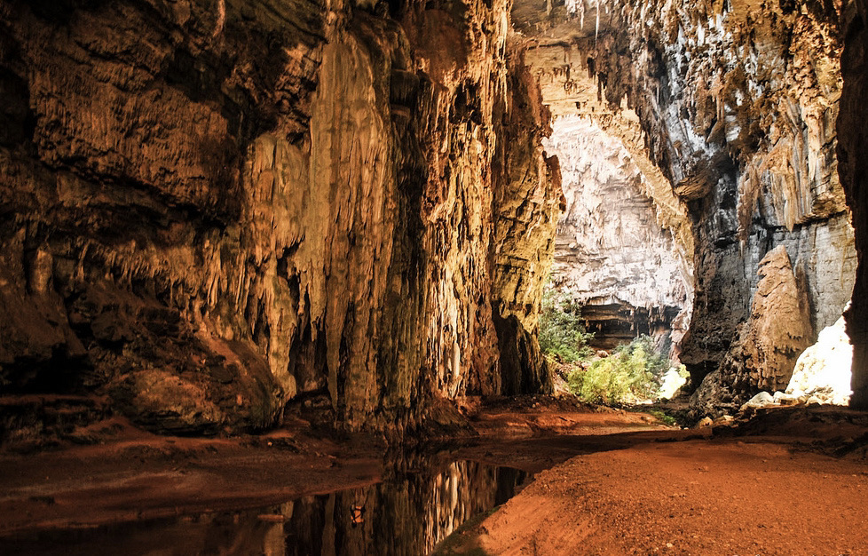
Unlike the Gruta do Janelão, the Gruta Bonita is totally dark. It is the only one of this type open to visitation. Inside, preserved halls and galleries are filled with speleothems – rock formations. It is in the Gruta Bonita where the famous Salão Vermelho (red hall) is found, covered by reddish sediments that make it unique.
The entrance of the Gruta do Índio has archaeological records reaching from the floor to the ceiling. The large panels of cave paintings are beautiful and impress by their state of conservation. In this cave, you can also find the Mirante do Índio viewpoint, which allows you to also see the entrance of the Gruta do Janelão.
Climate info
Hottest month |
October (25 °C avg) |
|
Coldest month |
July (21 °C avg) |
|
Wettest month |
December (143.8 mm avg) |
|
Windiest month |
September (13 km/h avg) |
|
Annual precip. |
528.3 mm (per year) |
You can visit the Cavernas do Peruaçu National Park throughout the year. From November to April is the rainy season, when the landscape is greener and brighter. From May to October is the dry season.
Parque Nacional do Itatiaia
The city of Itatiaia is synonymous with ecotourism, and is a great choice for those who want to escape the hustle of large urban centers and enjoy days of peace and tranquility in nature – whether with family, alone or with friends.
Divided into two parts, the high and low part, the Itatiaia National Park has activities for all lovers of nature. The lower part is ideal for those looking for something more peaceful with short, easily accessible trails and several waterfalls.
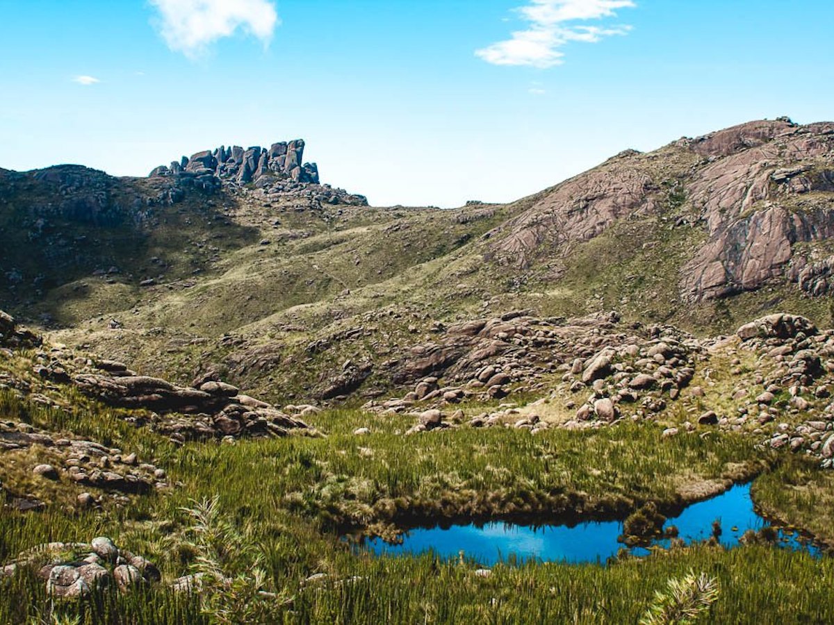
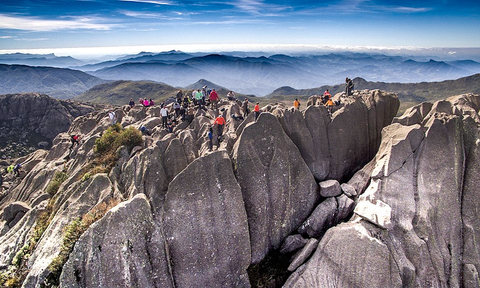
The high part is ideal for those who prefer adventure and adrenaline, with trails of high difficulty and always heading to the top, to enjoy the fascinating views and admire the various rock formations such as Pico das Agulhas Negras. It is the oldest national park in the country.
What to do in Itatiaia
The low part is where the trails, waterfalls and viewpoints are located, with the easiest access, without requiring a lot of effort and physical preparation. And in less than one kilometer of walking, you can already reach some of the waterfalls. Around here, you will be enchanted by the preserved forest and also have the experience of encountering different animals along the way.
Cachoeira Véu da Noiva It is the most beautiful waterfall in the Itatiaia National Park, which presents its visitors with a 40 meter high drop, which looks like a wedding veil. The Véu da Noiva waterfall is perfect for those looking for contact with nature and admiring all its beauty. The water, like the other waterfalls, is quite cold, but it's worth a dip to renew your energy. The low part offers various other waterfalls, such as the Cachoeira Itaporani and Cachoeira do Poranga, as well as lagoons, natural pools and hiking trails.
The high part offers a lot of peaks and lookouts, which provide beautiful views of the Serra da Mantiqueira and the Vale do Paraíba. There you will find the famous Pico das Agulhas Negras and Pico das Prateleiras, one of the main attractions of the high part of the park.
One of the most popular tourist spots in Itatiaia is the Pico das Agulhas Negras. It is the fifth largest in Brazil, with its 2791 meters of altitude, and the highest in Rio de Janeiro. The peak is a rocky mountain with unusual and surprising shapes, considered one of the most beautiful in Brazil. You can choose to climb to its base or even to the summit.
Climate info
Hottest month |
February (26 °C avg) |
|
Coldest month |
July (20 °C avg) |
|
Wettest month |
January (370.8 mm avg) |
|
Windiest month |
September (8 km/h avg) |
|
Annual precip. |
1728.3 mm (per year) |

